North dakota flooding

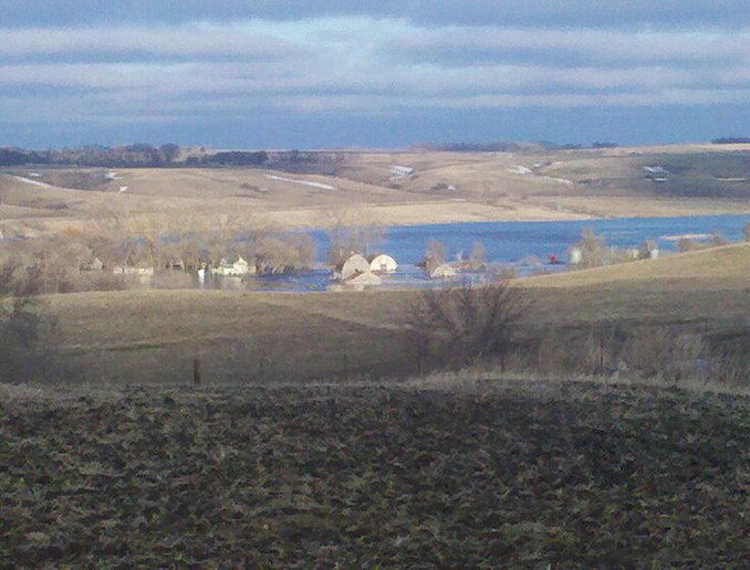
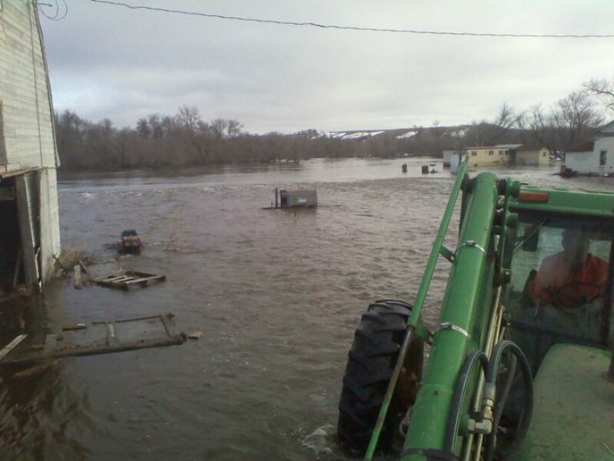
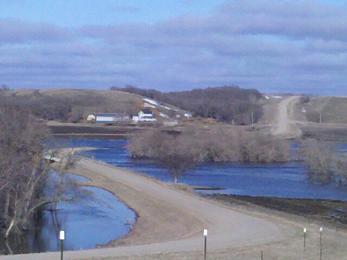
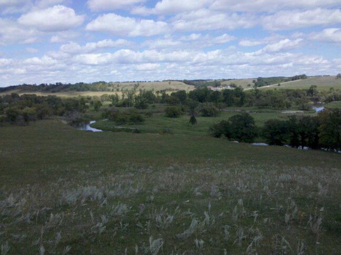
Pics from Grandpas farm were I spent alot of time as a kid . Place never flooded since great grampa built it . sad to see .
a37469.jpg

a37470.jpg

a37471.jpg

a37473.jpg
 
I know what you mean. What's making this happen all the time now? Here in the Mankato, Mn. area we are getting 100 year floods every other year.
 
Pretty wild events . all the sloughs up there are full for several years now . Devils Lake is raising up fast . Millions of years ago , it was all covered with water at some time. Maybe that cycle is due ? makes you wonder don't it .
 
Devils lake has risen nearly 35 feet in the last 20 years and spread out to be a lake 60 miles long. It has put thousands of farm land under water. Hundreds of millions of tax dollars has been spent to move towns, build dikes and buy out homes. Canada and areas down stream from the lake have blocked efferts to open a coulee that filled in with blow dirt in the 30's. This may soon end with a flood never seen before as the lake is within a few feet of spilling over naturally. When it starts on the blow dirt it will empty in a hurry. The blow dirt is about 20 feet deep. Environmetalist at work!
 
The Devils lake /Stump Lake phenom is quite the geological event. Sad to see so much damage,but neat to witness this event that has happened twice in the last 4000 years. I remember as a kid Stump lake being a briny shallow slough . No fish .Now is is one of the hotest fishing spots, great boating etc. With Devils lake now flowing into Stump,which may soon flow into Tolna Dam ,which will then overflow washing out soft earth,,which then flood Sheyenne vally ,rumored to take out every bridge to Fargo . Unless some sort of managed outlet is built . Canada and down stream folks don't want the water, but they may get it all at once weather they want it or not.
 
100 year floods nearly every year? It's due to
greedy people plowing from fencerow to fencerow,
and plowing up the CRP acreage for corn, for ethynol, and the water just runs off the bare
ground...no place to slowly be absorbed !
(I thought i'd just "stir the pot")
 
I drive through Devils Lake often and always found it kind of erie to see the tops of what were once tall trees kinda poking up out of the lake here and there.
Was that area part of Lake Aggasiz? I know our area of Ontario was once pretty much the shores of the huge lake. Seems possible that eventually it will all be under water again.
http://en.wikipedia.org/wiki/Lake_Agassiz

This may seem like a stupid question but I was just looking at Devils Lake on Google maps (the satellite view) and I see what looks like roads where the lake now is. How big was it to start with and how much has it expanded over the years?
 
Years ago the beaver helped to hold the water back until man trapped them out. We should be building water treatment plants and put some of that water back underground. At one time The north pole used to be just north of Wisconsin. The earth had a pole shift & the melting ice formed ancient Lake Agassiz which drained down forming the Mississippi and Red rivers.
 
No. The Des Lacs river is northwest of Minot. It drains into the Mouse (Souris in Canada) river. It is small but drains a big area.When the Des Lacs water drains into the Mouse at the same time as the peak water comes from Canada--look out. There will be flooding down the river.
 

We sell tractor parts! We have the parts you need to repair your tractor - the right parts. Our low prices and years of research make us your best choice when you need parts. Shop Online Today.

Back
Top